
What an Atwater Street Search Can Establish
The useful question is what an Atwater street-by-address search can establish, not whether one result names every person. An Atwater address can lead to a parcel, an APN, an assessment record, a permit file, and a deed chain. Those Atwater records can show an ownership interest, a legal description, a transfer date, construction activity, or an Atwater jurisdiction. They do not turn an Atwater street into a complete resident roster. Occupants may appear only in a dated directory, a permitted application, a court filing, or an authorized election record.
Use the Atwater chain in order. Each step narrows the next search and keeps property evidence apart from household evidence.
- Normalize the Atwater street address through the Merced County Tax Collector search, then note the APN or parcel clue.
- Open the Merced County GIS map or parcel-map download and inspect the target Atwater lot and its neighbors.
- Carry the Atwater APN into Assessment Inquiry, while treating its online result as assessment data rather than an owner list.
- Use Accela for Atwater permits, planning records, and code-related address clues, with the city and county split in mind.
- Search RecorderWorks by party name, open the Atwater deed detail, and follow each grantor back as an earlier grantee.
- Use voter self-status, dated Atwater street sections, and household sources only for the narrow question each record can answer.
Atwater Records Searchable by Street
Atwater records searchable by street are spread across county property systems, municipal permit files, state election tools, and historical volumes. The same address is not a universal key. Tax and GIS tools tend to use an APN or map location, RecorderWorks uses party names and document fields, and a directory uses the publication year and street section. The coverage below marks what each source can support without overstating it.
| Record Set | Custodian | Address Key | What It Can Establish | Access / Limit |
|---|---|---|---|---|
| Atwater Tax Collector property search | Merced County Tax Collector | Normalized address or APN | Tax bill and delinquency clues tied to an APN | Online route; not an occupant list |
| Atwater Assessment Inquiry | Merced County Assessor | Fee parcel or assessment number | Parcel status, values, exemptions, characteristics, and maps | Free APN mode; online owner/address search disabled |
| Atwater GIS and parcel maps | Merced County GIS / Assessor | Map location, APN, BK/PG | Lot geometry, adjacency, jurisdiction, and map context | Free viewer or PDF; not title proof |
| Atwater Accela permits | Merced County and Atwater offices | Address, parcel, city, or ZIP | Permit, planning, enforcement, applicant, and professional clues | Jurisdiction split; functions vary by account |
| Atwater recorded deeds and liens | Merced Assessor-Clerk-Recorder | Party name, APN, legal description | Transfer parties, dates, document numbers, and parcel chain | 1963+ index online; copies ordered |
| Atwater voter status | California SOS / Merced Elections | One voter's identity | That voter's status, districts, and election details | Self-lookup; no public street browse |
| Atwater historical street section | Museum, library, NARA context | Street and publication year | Dated subscriber, householder, spouse, or affiliation clue | Collection-specific and often in person |
The parcel number joins an Atwater assessment map to an Atwater deed or permit. The legal description is the safer bridge when an Atwater street label changes. A dated Atwater directory entry can then add household context, but it remains publication-date evidence, not proof that a person stayed at the Atwater address all year.
Atwater Address to APN
The Merced County Tax Collector is the practical bridge when only an Atwater street address is known. Its property search guidance says to drop words such as Street, Road, Drive, and Lane, keep directionals as N, E, S, or W, and try a short number-first search when a full address fails.
The Atwater Tax Collector address search gives a useful pattern: for 1234 West 32nd Street, try 1234, then 1234 W, then 1234 W 32nd. Carry the resulting APN into the county's Atwater Assessment Inquiry. The online assessor mode accepts only a fee parcel number or assessment number. Owner-name and address search are disabled online, so a web result must not be described as an owner or mailing-address lookup.
The Atwater Tax Collector property search guidance is the address-normalization step that keeps a failed full-string search from ending the Atwater trail.
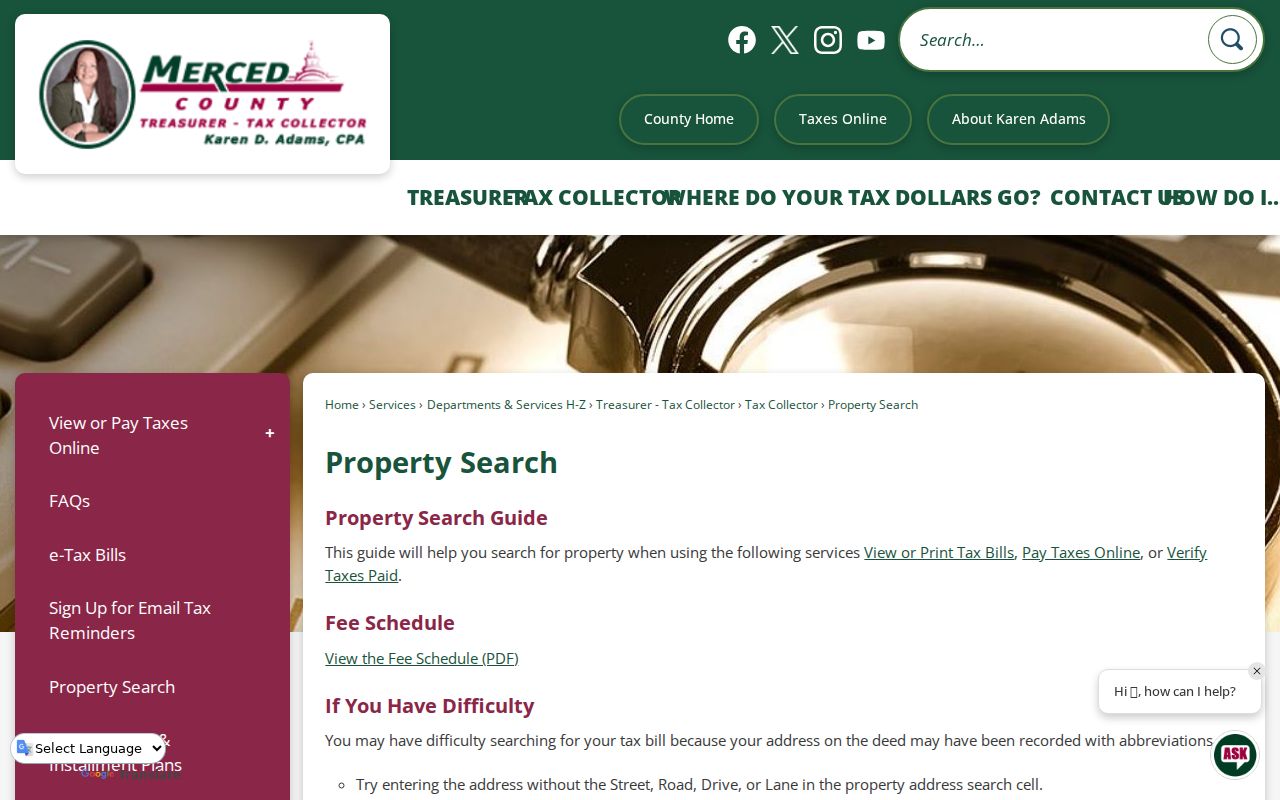
The Atwater Tax Collector screen supports a short, staged address search before the APN is carried into Assessment Inquiry. That sequence is more faithful to the county's published limits than an assumed Atwater owner-name search.
Note: Tax-bill information can locate a parcel, but it does not establish who occupies the property.
Atwater Street Parcel Maps and GIS Limits
Once an Atwater APN is in hand, the Merced County GIS viewer can place the Atwater lot in its street and parcel setting. The county's Atwater assessor parcel-map download asks for BK and PG, a CAPTCHA, and a download action. The first five APN digits correspond to map book and page, which helps connect an Atwater map sheet to the Atwater assessment record.
The Atwater parcel-map download is an assessment tool, not a title report. The county says its map does not establish legal ownership, zoning, or lawful subdivisions. A live official parcel popup could not be defensibly inspected during research, so Atwater GIS layers and fields should be checked on the current viewer rather than guessed from a screenshot.
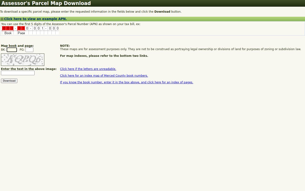
The linked Atwater parcel-map screen shows the map-book and page route that turns an Atwater APN clue into a map sheet. Use the legal description and current Atwater custodian record before attaching a lot to a person.
Atwater Street Permit Search Fields in Accela
Merced County's Atwater Accela address and parcel lookup is the most explicit Atwater address-field tool in the local record chain. It supports a range search and a street-name wildcard, so it can approximate an Atwater block permit sweep. It is an Atwater permit and planning route, not a resident database.
The Atwater address screen uses the following controls. A blank optional field does not mean the record lacks that fact; it means the search form did not require it.
| Field | Type | Required / Format |
|---|---|---|
| Street Number from/to | Atwater number pair | Minimum street number advised; range can cover a block |
| Direction | Dropdown | Optional; examples include S |
| Street Name | Text | Optional; percent sign works as a starting-letter wildcard, such as M% |
| Street Type / Suffix | Dropdowns | Optional; option lists load from the portal |
| Unit Type / Unit No. | Dropdown / text | Optional multifamily refinement |
| City / State / Zip | Text | Optional Atwater postal filter |
| Address date/detail/type/home-address | Date, text, dropdown | Optional advanced property metadata |
| Look Up / Clear | Buttons | Run or reset the search |
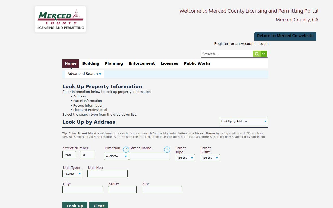
The Atwater Accela APO screen makes the street-number range, wildcard, unit, city, state, and ZIP choices visible. Atwater results still need a jurisdiction check before they are tied to an Atwater city parcel.
Atwater Street Permits and Jurisdiction Layers
The broader Merced County permit and planning portal covers county workflows, but an Atwater mailing city does not settle which office holds an Atwater permit. City projects go through Atwater Community Development, City Clerk requests, or city building channels. Unincorporated work goes through county Accela.
Atwater's sphere-of-influence, zoning, transportation, redevelopment, and general-plan maps help decide that split. For Atwater city-held permit cards, applications, inspection histories, certificates of occupancy, or plans, a request can name the situs address or APN, department, project, and date span. Atwater permit applicants and professionals may be named, but that link is evidence of a filing or project, not proof of residence.
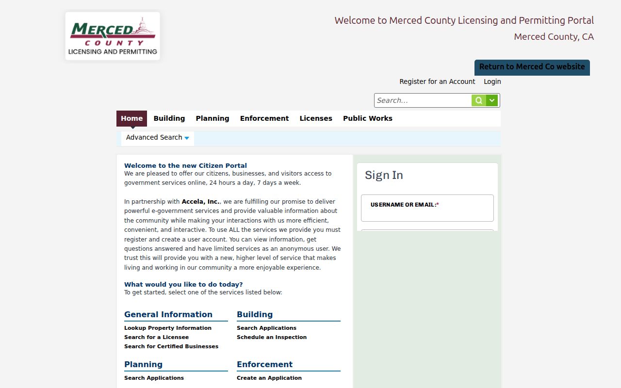
The linked Merced portal is the county-side route for Atwater address records. Check the Atwater boundary maps before treating a county permit result as an Atwater city-held file.
Trace an Atwater Street Through RecorderWorks
Atwater deeds are indexed by names, not necessarily by street. In RecorderWorks, enter a last name and a partial first name when possible, choose the indexed role when the portal offers it, and add a recording-date pair. The public online start is January 1, 1963. An Atwater result can show a document number, indexed party and role, document type, and recording date. Opening the document number and then selecting a name can expose the other indexed Atwater documents tied to that party.
For an Atwater address chain, treat the current deed's grantee as the starting owner, record the legal description, then search a prior grantor as an earlier grantee. Confirm the same parcel on the deed or ordered copy. The index is free, but a copy is not necessarily a free Internet image. Recorded-document copies cost $3 for the first page, $1 for each additional page, and $2 for certification per document; mail and card procedures add their stated charges.
Pre-1963 work does not end at the Atwater web cutoff. Earlier official records must be searched at the Merced Recorder counter, 2222 M Street, using the deed books, party names, and the legal description. For a one-person question after the Atwater parcel chain is clear, the Atwater resident lookup workflow adds court, vital, business, and license checks.
Note: A namesake can own several parcels, so legal description and APN must confirm every deed connection.
Atwater Street Sphere Map Sets Jurisdiction
Atwater is an incorporated Merced County city, yet an Atwater postal label can cover land outside the city. The official Atwater city maps include the sphere of influence and planning layers needed to test that Atwater boundary. Use the map before sending an Atwater city request or treating a county permit result as a municipal record.
The Atwater sphere is not the same as the incorporated limit, and neither is the same as a ZIP boundary. An Atwater parcel may sit in the county while using Atwater in its mailing address. Record the event jurisdiction beside the APN, permit, deed, or directory clue so that an Atwater street-by-street result does not mix city and unincorporated records.
Atwater's 2007 Street ZIP Quirk
Atwater postal history can look like a move when the land did not move. Postal Bulletin 22206, dated May 10, 2007, directed some deliveries that had used Merced 95340 to use Atwater 95301. Preserve both the old and new ZIP, along with the effective date, when an Atwater directory, tax notice, or newspaper item appears to change cities.
ZIP 95301 reaches the incorporated city and surrounding unincorporated Merced County delivery territory. It belongs to delivery routing, not title identity. For an exact Atwater address, the USPS ZIP Code Lookup can verify the postal label, while the Atwater sphere and zoning maps decide municipal jurisdiction.
Note: A ZIP change can explain a new city label in an old record without proving a new residence.
Read Atwater Streets in Criss-Cross Volumes
An Atwater historical street section can add a named subscriber or householder to a parcel trail, but it is tied to a publication year. Merced County collections include regional Merced and Merced-Atwater volumes, with Atwater street sections and cross-references that can bridge a house between directory years. An entry may show a name, address, spouse note, occupation, telephone, rural route, or owner/non-owner symbol, depending on the volume.
The historical shelf belongs with the collections, entry conventions, and census pairings described in the Atwater city directory collections. For a current Atwater street question, use a dated volume as one household clue after the APN and deed steps, not as proof that every adult at an Atwater parcel was listed.
Atwater Address Definitions
Four terms keep an Atwater street directory search from joining records that only look alike. The distinctions matter when an Atwater map, tax record, deed, and directory use different address language.
- Atwater parcel
- A mapped piece of land tracked by an APN. An Atwater parcel can contain a structure, several units, or no house at all.
- Atwater situs address
- The physical location of the parcel. It can differ from the mailing address used by an owner or taxpayer.
- Atwater plat
- A recorded or assessment map showing lots, blocks, roads, or subdivision layout. An Atwater plat helps locate land but does not replace a title record.
- Atwater criss-cross directory
- A reverse directory arranged by street and address rather than only by surname. It supplies a dated household or subscriber clue.
Privacy Limits for Atwater Street Records
An Atwater street directory cannot show every person connected to an address. Atwater assessment and deed records concern property interests. Voter status confirms the querying voter's own registration, while voter-file access requires an approved purpose and a county or state application. DMV address data is closed under the Driver's Privacy Protection Act. Utility customer lists, protected registrations, Safe at Home substitute addresses, and household details are not open Atwater street fields.
California's public-record rules do not erase Atwater category limits. A custodian may redact protected information, and a missing Atwater web address may reflect a legal safeguard rather than a missing person. Use an official counter or request route when a record category allows it, and stop when the record does not authorize a personal detail.
Lawful use. Atwater address records are for personal, lawful research such as family history, property history, or civic review. Do not use a street directory to stalk, harass, threaten, intimidate, or make unwanted contact with any person.